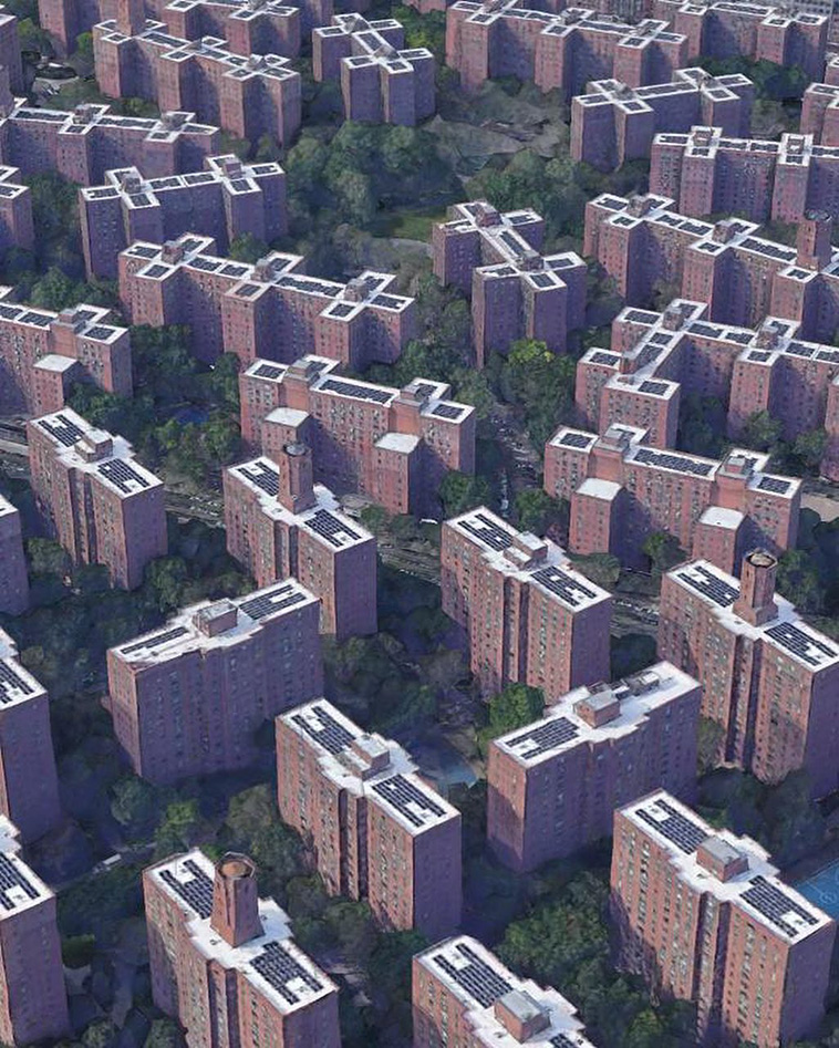
New program wants to improve cities with the power of tweets and Flickr uploads

It?s called Urban Pulse Want to watch street life unfold outside of New York?s Metropolitan Museum of Art, long after it?s closed for the day" Or uncover the hidden ways both tourists and locals alike use Manhattan?s most famous landmarks" Now you can, all thanks to the power of data.
Urban Pulse, open-source software developed at NYU?s Tandon School of Engineering, uses data to create a map that visualizes how people move through cities. From Urban Pulse?s interface, you can observe, for example, how tourists navigate Central Park.
Sociologists Robert Park and Ernest Burgess, who worked in the early years of the 20th century, developed a theory of urban environments that used the human body as an organizing analogy: They likened the mundane processes of everyday urban life (things like phone calls and taxi rides) to the heartbeat. Urban Pulse brings that analogy into the 21st century, replacing statistics about phone calls with social media and other digital data.
Essentially, Urban Pulse is a dynamic, comparative heat map. And the hot spots on the map are made up of what the research team dubbed ?pulses? and ?beats,? terminology that was inspired by Park and Burgess?s original analogy.
But Urban Pulse?s findings don?t simply reinforce what we already know about cities. By pinpointing how, when, and by whom city spaces are most often used, the data has the power to upend our preconceptions about civic space. This has potentially far-reaching...
| -------------------------------- |
| PERPENDICULAR EN UN PUNTO DE UNA RECTA |
|
|

Classic White Kitchen Appliances Are Reclaiming Their Place in the Heart of the Home
19-05-2024 08:17 - (
architecture )