Explore rapid global urbanization with updated Google Timelapse tool
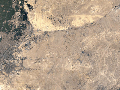
See cities proliferate before your eyes Here?s something fun to head into the weekend with: Google just made some major updates to its Timelapse feature, which uses over 5 million satellite images to show how the earth has changed since 1984, as seen from above.
First launched in 2013, the tool lets you search for specific locales, as well as pan and zoom to study changes in detail. The updates this week add perabytes of new data, sharper views, and four more years of imagery?which doesn?t sound like a whole lot of time, but in the case of Greenland at least (where a massive amount of ice has been lost in the last four years), the change is all too evident. Below, we?ve pulled out a few specific places to check out. You can explore Timelapse yourself here.
Cairo
Dubai
Shanghai
Las Vegas
On the northerneastern tip of Greenland
Via: ArchDaily
...
| -------------------------------- |
| Snarkitecture explores the changing states of water for Caesarstone installation |
|
|